 September 21, 2024
Mt. Democrat North Ridge, Cameron, Bross, Lincoln
12 miles, 5,100’ elevation gain
Both Laura and I have climbed the four peaks in the past,
several times grouping each of the four to complete the so called the Decalibron
loop. In 2022, we also climbed Mt. Democrat, in winter, as the first mountain
after Laura had returned from a broken ankle.
 |
Ptarmigan in the basin below Democrat
|
I had mentioned climbing the north ridge in the past and while
we discussed the route, we never made an effort to climb it. Today, we were once
again looking for a half day trip that was nearby our cabin located in the
Placer Valley just above Montgomery Reservoir. Since we wanted something new
and did not have a shuttle to exit out to Kite Lake, we decided to start our
morning at the Wheeler Lake trailhead located off of county road 4 near Hoosier
pass.
 |
| Looking at the north ridge of Mount Democrat while approaching from Montgomery Reservoir |
We accessed the route by hiking up Wheeler Lake road for about 2.75 miles. The road is easy to follow. About a mile before you
reach Wheeler Lake, you cut off the road and hike off trail over easy grassy
and rocky terrain to reach Democrats class three north ridge.
 |
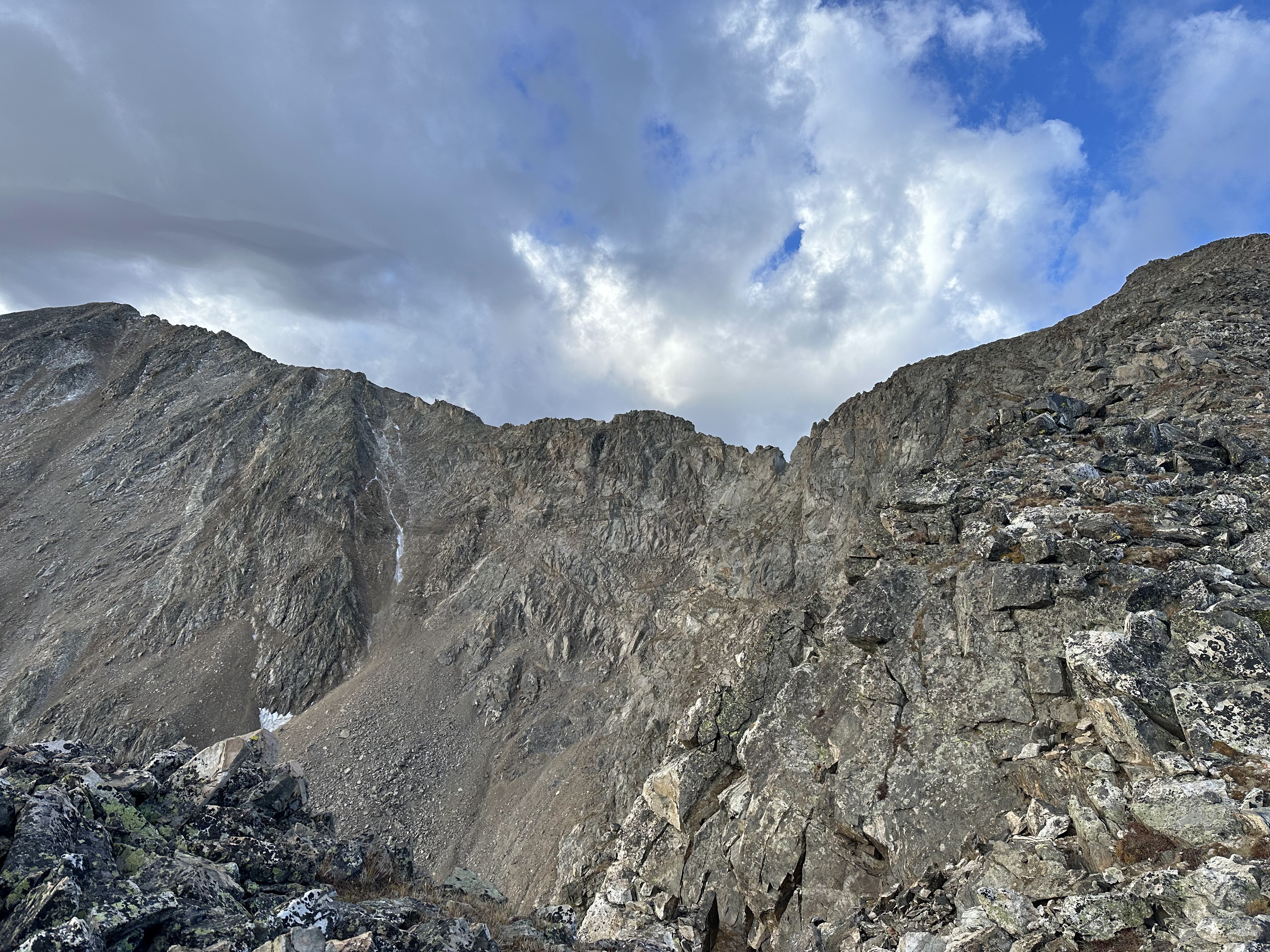
| View of the Democrat north ridge from the approach |
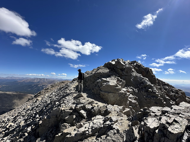
The ridge is about a half mile long and has several sections of class 3 scrambling. At no point is it overly exposed and it is straight forward and
quite an enjoyable romp as long as you choose a good path. The ridge leads
directly to the generally crowded Mt. Democrat summit.
 |
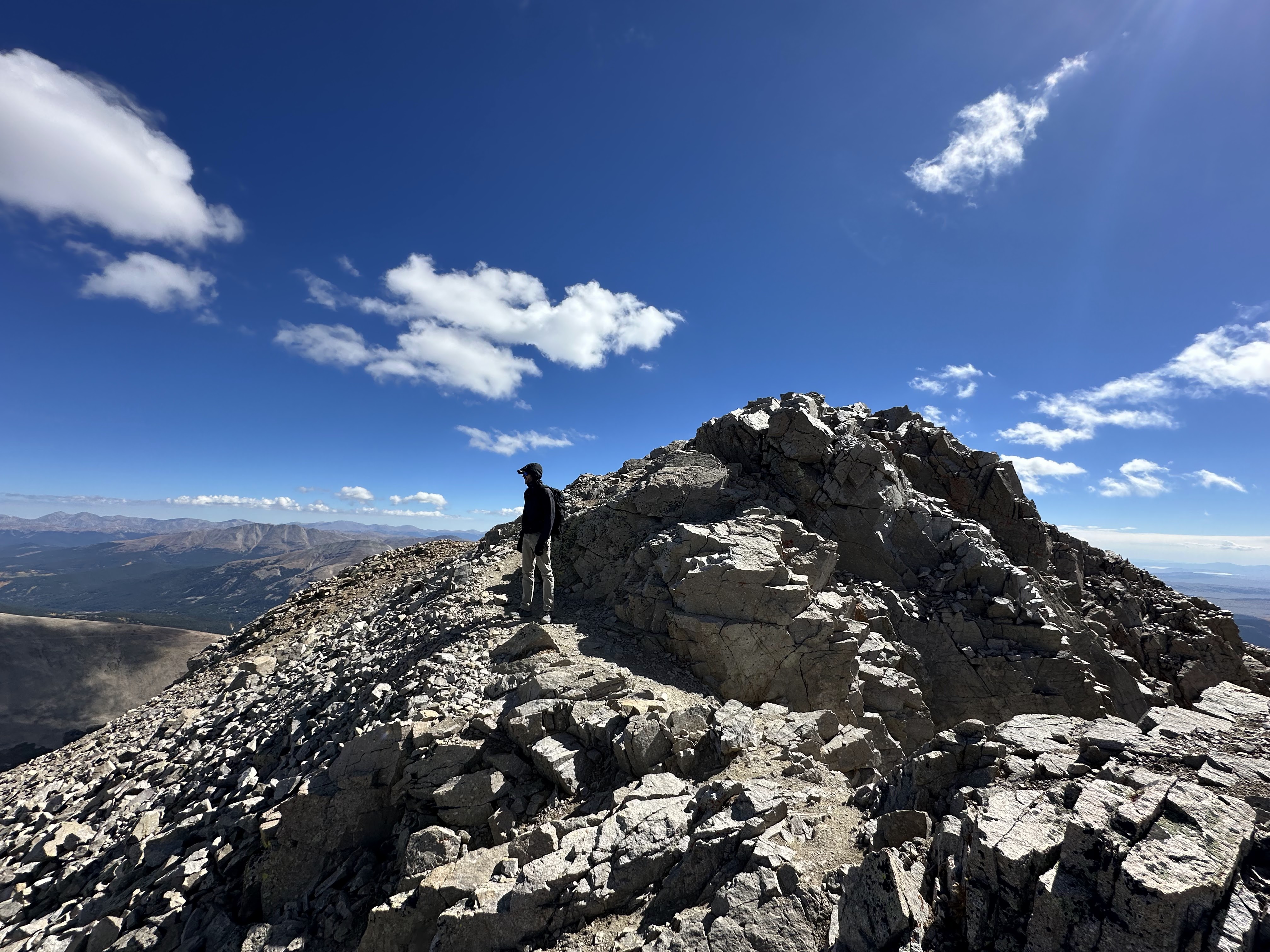
| Justin on the north ridge of Mount Democrat |
 |
| Justin on the north ridge of Mount Democrat |
It took us roughly 2 hours of hiking to reach the ridge. We scrambled along the ridge for only about 30 minutes before reaching the summit. We saw zero other hikers or climbers
along our route, but when we reached the summit of Mt. Democrat, there was the
usual crowd of hikers who had ascended from Kite Lake.
 |
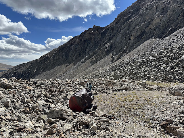
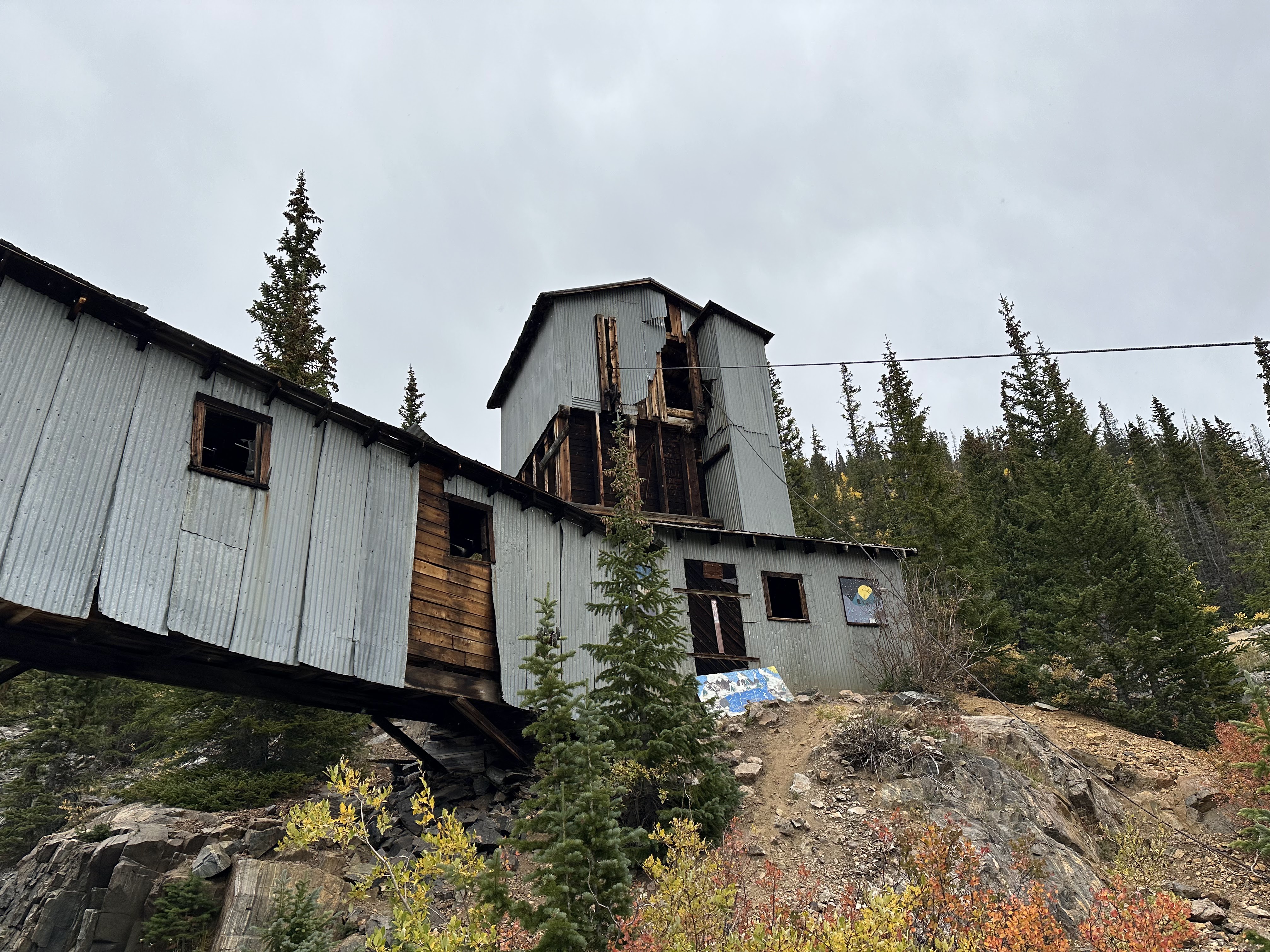
| Justin in front of a collapsed mining structure near the summit of Mount Democrat |
Spending just a few minutes at the summit, Laura and I took
a selfie and quickly headed toward Mt Cameron. As we walked along the heavily
traveled standard route of the Decalibron we encountered kids from 8 years old
to folks in their mid-70s. We crossed over the bump on Mt Cameron, collecting a
handful of cardboard signs along the way, and continued down the well beaten
path until we located easy access that dropped us down to meet up with the
trail leading to Mt Bross.
 |
| Laura and Justin on Mount Cameron |
Walking across the trail we reached Mt Bross in just 30 minutes. As the wind
picked up, we took cover at the summit behind the makeshift rock shelter for a
few minutes to have a snack. We soon were moving again, and making our way back
and over to Mt Lincoln. It took us 55 minutes to reach the summit of Mt Lincoln, where once
again, I collected another handful of cardboard signs before descending toward
the Lincoln amphitheater.
 |
| Laura and Justin on the summit of Mount Bross |
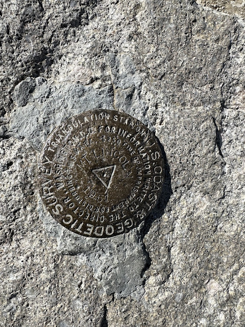 |
| USGS marker on the summit of Mount Lincoln |
Although the amphitheater descent route is not marked and
does not have an established trail, it is an easy enough route to find. Simply
pick your path to the east down the rock filled amphitheater gully and descend rocky
and grassy slopes for several thousand feet, eventually leading to the upper
portions of the Lincoln Falls ice climbs that form in the winter time. From the top of the ice climb cliffs, continue
down the beaten path toward Montgomery Reservoir and once again reach your car.
It took us 1.5 hours to descend from the summit from Mt Lincoln for a round trip time of 7 hours. In total, the day comes in at just over 12 miles and 5,100' of elevation gain.
 |
| Justin walking down into the amphitheater on Mount Lincoln |
This is a fantastic alternate route if you have some basic
navigation skills and are comfortable in class 3 terrain, and would like to
avoid the crowds, if only for the first and last 1/4 of your day.
 |
| Justin on the north ridge of Mount Democrat |
 |
| Justin checking out the views from the top of Mount Democrat |
 |
| Justin on Mount Bross |
 |
| Laura at the summit of Mount Lincoln |
 |
| Mine remnants on Mount Lincoln |
 |
| More mining waste on Mount Lincoln |
 |
| View of Magnolia Mill from the east slopes of Mount Lincon |
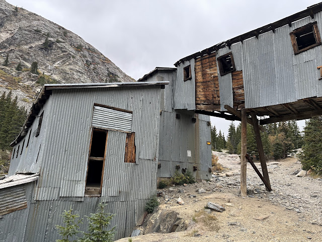 |
| Magnolia Mill |
 |
| Magnolia Mill |
 |
| Picture of the GPS route for the day |
 September 21, 2024


No comments:
Post a Comment