September 24-25, 2022
Longs Peak Keyhole Ridge
Rocky Mountain National Park
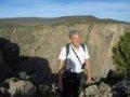
It's Autumn once again and that means mountains with changing aspens. Laura was able to reserve a campsite in RMNP for the weekend. We were excited because the elk rut is in full swing and we hoped to see some great fall colors. We also had a route on Longs Peak on our mind for a while called Keyhole Ridge.
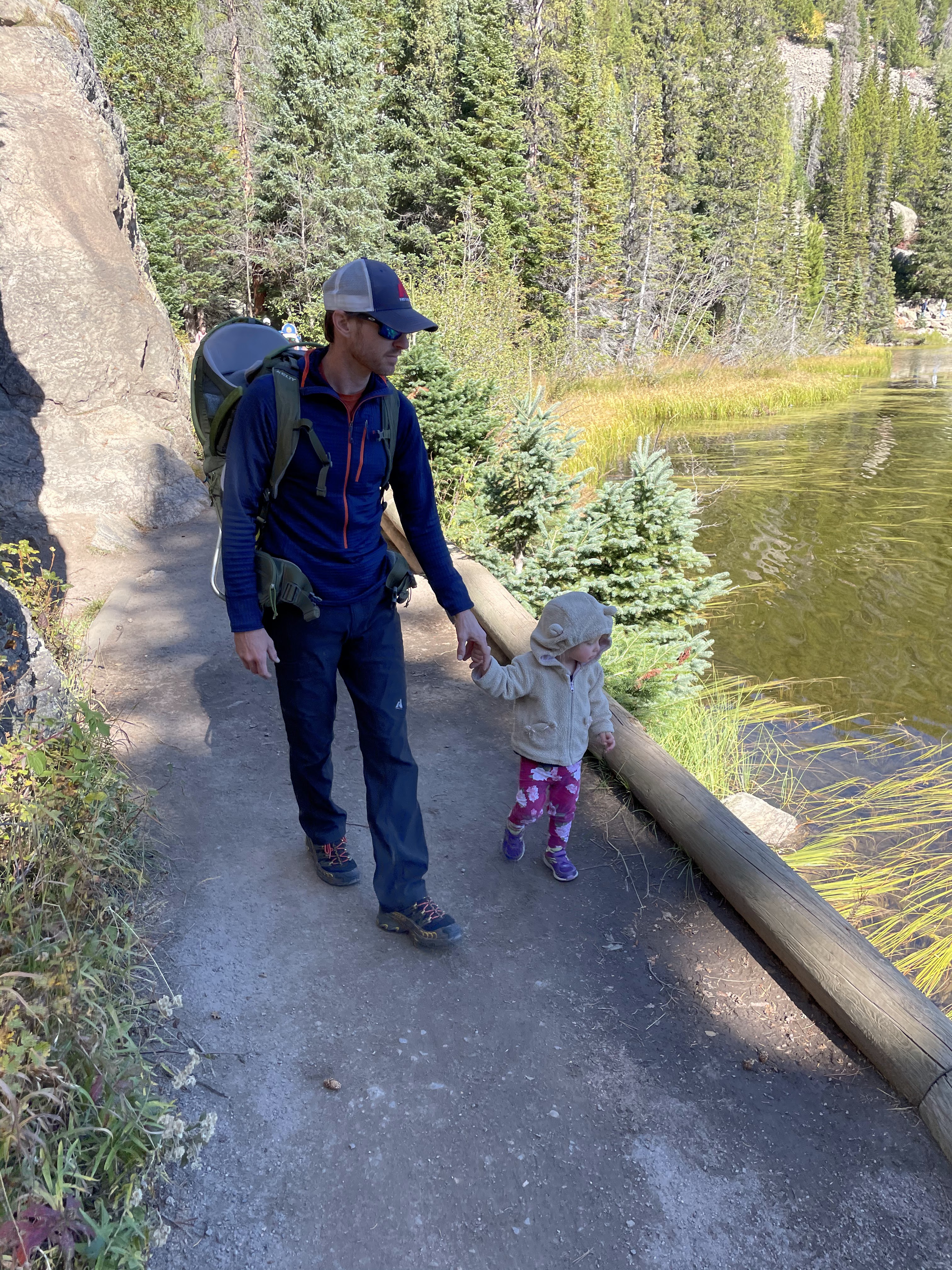
We met Grandma at the Moraine Park campground Friday evening, had dinner and a fire and listened to the elk bugle as we fell asleep that night.
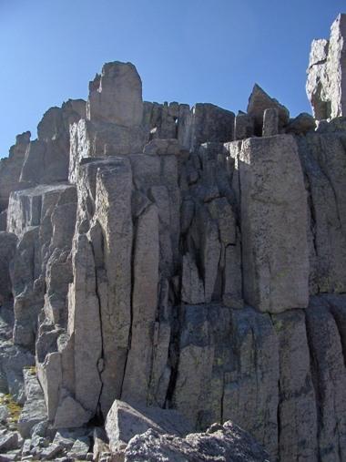
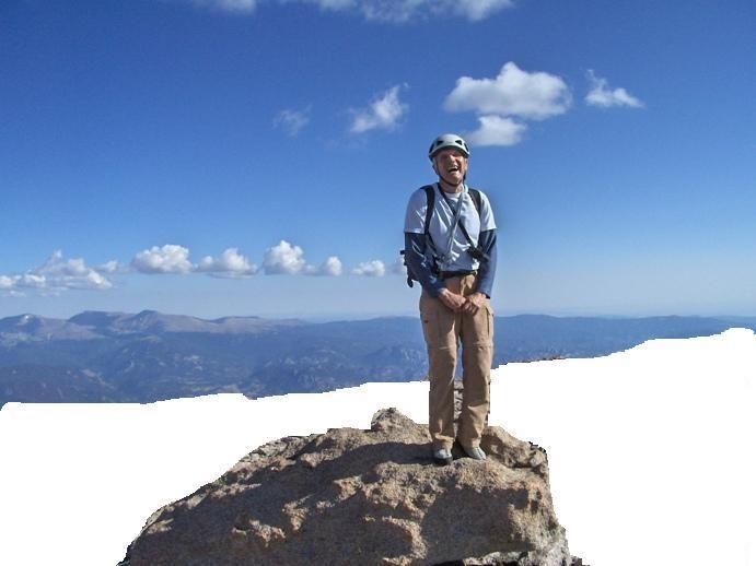
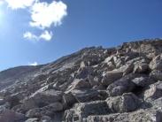
The following morning, Laura and I headed out from the campground at 5 am and were parked alongside the road below the Longs Peak trailhead by 5:45. We grabbed our packs and got moving quickly. The wind was blowing and as we made our approach toward the very popular standard Keyhole route, we spoke with several groups who had turned back because of high winds. We were a bit concerned about climbing the exposed class 5 ridge in the wind but figured we would at least go check it out and make a decision once we got up there.
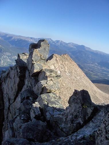
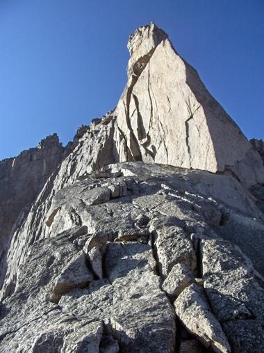
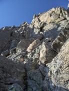
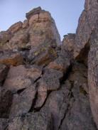
We approached the ridge and followed a ramp on the left side, bypassing the first tower. We simuclimbed for 200' on the ridge just before the second tower. The terrain was maybe 5.5 or so.
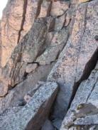
At the second tower, we downclimbed around a loose boulder. The boulder is large, 4' x 4' and moved when both Laura and I were pushing on it. This boulder needs to be removed before it comes off and kills a climber or someone below in the trough.
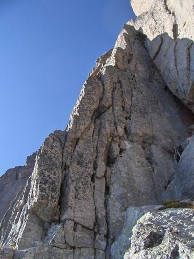
We located a narrow ledge that bypasses the second tower and then ascended a ramp to a platform. Once you step up on the platform climb directly up at about 5.6 for 40 feet, passing a fixed pin about half way up. We belayed this section as it is the crux of the route.
Laura quickly followed and we unroped shortly after and followed the path of least resistance to the summit.
We had fun getting back on a technical route in the mountains after almost a full year away since Laura had broken her ankle. We descended cables route in three rappels and felt like the standard route down would likely be just as efficient.
Our friend Roland wrote an excellent trip report of the route as well and it is copied at the bottom of this blog post.
That night we made dinner over a campfire and once again retired to bed listening to the elk bugle. Sunday morning we watched several groups of elk and then, from Bear Lake, Laura, Hazel and I hiked up to Hiyaha Lake and checked out the turquoise color that was caused by recent rockfall on Hallet Peak. We then drove old fall river road to trail ridge road and back to Estes Park for a quick dinner before heading home.
We had a great weekend and we will make this an annual trip since we really enjoy the elk and the fall colors in the park!
Roland's Trip Report - Keyhole Ridge


View Trip Report
Peak: | Longs Peak - 14,255 feet | Post Date: | 09/09/2009 | Date Climbed: | 09/05/2009 | Posted By: | roland |
| |
Longs Peak - Keyhole Ridge |
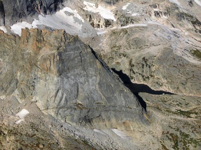
Longs Peak by the Keyhole Ridge.
By 3am Saturday I was driving North on Hwy25 from Colorado Springs to the Longs Peak Ranger station.
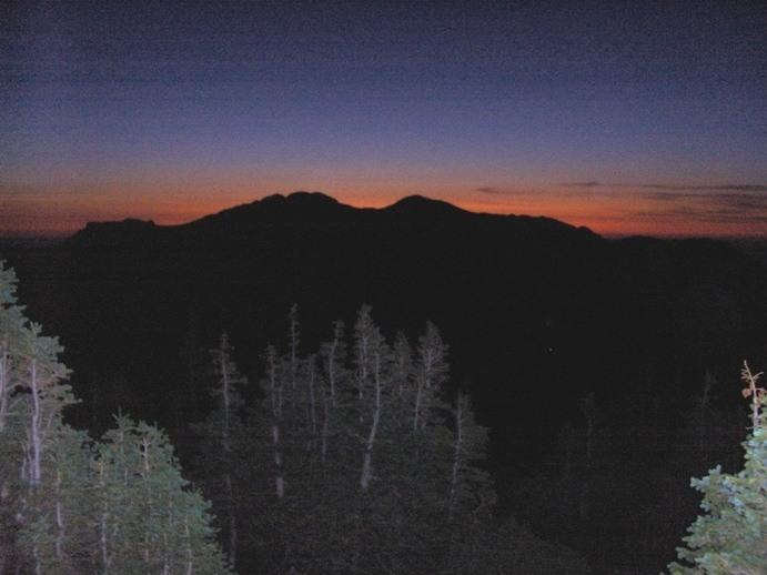
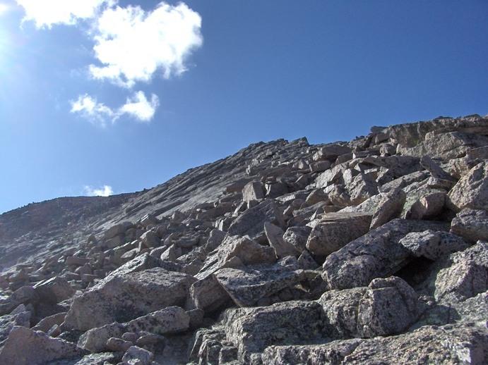
After I found a place to park I left my car around 5:30am. I got to timberline just in time to catch the sunrise

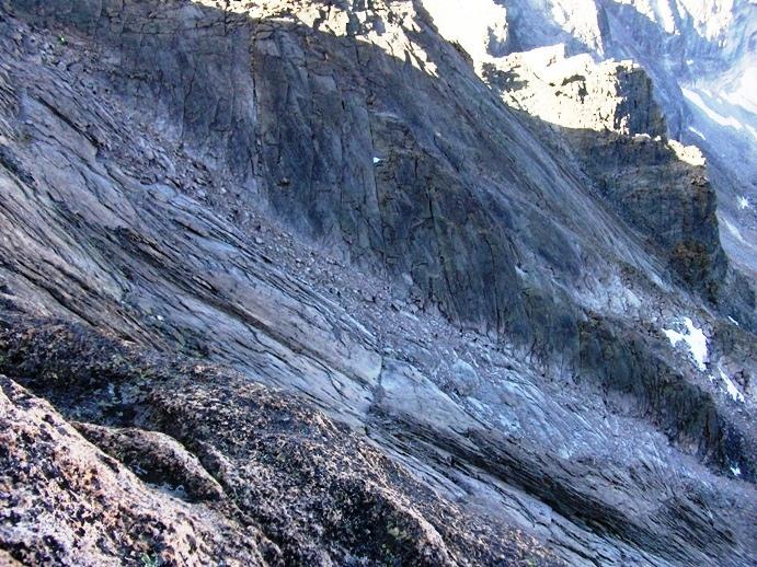
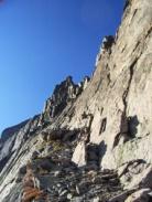
Then I followed the trail to just below the Keyhole. The weather was very nice, blue sky, no wind, perfect for a ridge ascent.
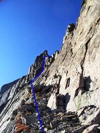
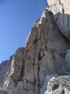
I followed the obvious ledge that leads from below the Keyhole to below the second tower on the ridge

This is the overall route I followed to get to the ridge crest, at a platform below the second tower
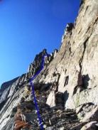
These are 2 shots showing the climbing from the end of the ledge to the platform

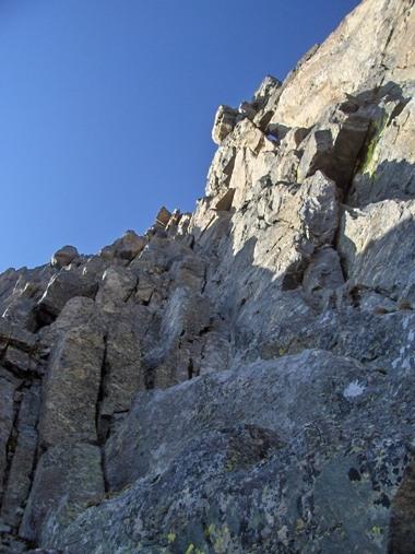
The climbing (or scrambling) isn't that difficult. May be class 4 or low class 5. If I have to believe some forums discussions on this site the
rating will vary if you're from Kansas or California.
Then you reached an obvious platform on the ridge crest about 100ft or so below the top of the second tower
.
Great view.
It seems possible to climb the East side of the Second tower, I got a glimpse of a yellow ramp with a crack in the back that should provide for a nice pitch, although it looks more difficult than the rest of the climb.
Wanting to keep it as easy as possible I opted instead to circle below the tower on its West side 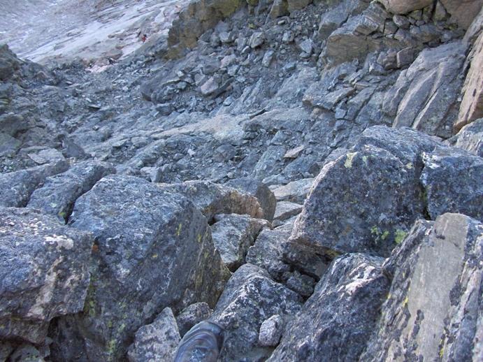
Climb down on the West side for about 50ft until you can traverse easily to the bottom of a 2 ramps system that will bring you back to the ridge crest between the second and third tower.
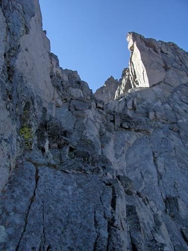
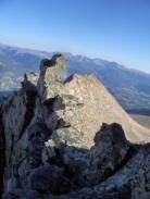
This is the view of the third tower when you reach the crest.
Follow the easy ramp to the bottom of the head wall. That's where I decided to change into my climbing shoes.
This is the "crux" (for lack of a better word) of the ascent the way I did it. Exposed but not very difficult, and the "difficult" part is rather short, no more than 20ft.
Step left on an obvious platform then climb straight up over 2 short walls staying close to the edge. You will encounter a fix pin on your left
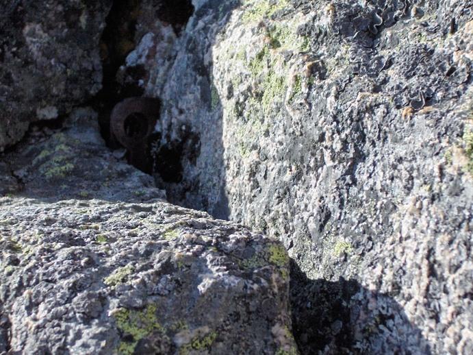
(I suggest to clip it to protect the second if you're belaying)
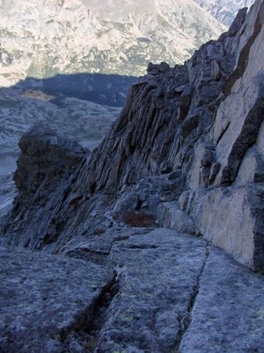
Then from there do an ascending traverse left on easy terrain to the ridge proper and enjoy the view
Another scramble up a chimney on the ridge
.
Go around a gendarme on the east side of the ridge 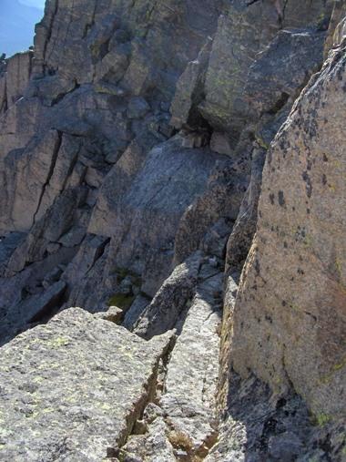


Feel lucky you're not going up the Through at this time
And follow the ridge
to Longs Peak summit block
I descended by the North Face (rappels) which was dry this time.
Can't pass Chasm View without a picture of the Diamond. A team is on the Yellow Wall (I think). I want to get there when I grow up.
.
Overall Keyhole Ridge is a very enjoyable (and fast) way to go up Longs if you're comfortable with the exposure and the easy "technical" climbing.
It doesn't have the mountaineering feel of Kiener or the Notch routes (no need for crampons & axe), but the views are great and it beats having to go up the often crowded Through.
Thumbnails for uploaded photos (click to open slideshow):
                     |
Go To Top |
|
dvanwicklin | Sweet 2009-09-09 12:20:47 Nice shots, & description of your climb. Curious what the portal to portal timeframe was. | 
| roland
 | time 2009-09-09 14:03:17 It took me 4hrs from the TH to the top. I walked pretty fast to the Keyhole then took my time on the ridge: pictures & choose the path that suit me best + really enjoyed the beautiful day & the climb.
BTW, it‘s also fairly easy to bail from this ridge if the weather turns bad:
- at the false Keyhole it‘s fairly easy to join back the trail
- from the platform below the second tower it is possible to keep on going down to the trail instead of climbing back up to the ridge crest
- after the 3rd tower it is possible to cross the upper North Face to the top eyebolt of the former Cable route w/o getting to the summit | 
| timstich
 | Nice TR! 2009-09-20 18:13:34 Hey, nice trip report there of your solo outing. Maybe we can get Laura to narrate her traverse of Notchtop Ridge. | 
|
|
Go To Top |
 September 24-25, 2022