"Fake" 10 Mile Range Traverse

10 Mile Range Traverse
August 27, 2022
"Fake" 10 Mile Range Traverse
Mt. Royal  --> Peak 10

With a plan to traverse the 10 mile range from Frisco / Mt Royal to Quandary Peak south of Breckenridge, Laura and I started walking from the parking lot in Frisco at 2:20 am. Friday evening had been rainy, therefore the ground was muddy and the moving quite a bit slower. As we went up the first peak, Mt Royal, Laura mentioned most people skip it because it really isn't "a peak". It's just a named peak and a bit out of the way. Laura was not feeling well and our pace was not what we normally would do on the first few miles. Reaching Mt Victoria, our second peak of the day, we encountered very wet and slick rocks which slowed us down even more. Scrambling was fun between peaks 2 and 4. but we quickly realized that we would not accomplish our goal of going all the way to Quandary. We made steady progress and had lots of fun over the next several peaks, all the way to peak 8 where we ran into a mountain friend of ours where we chatted for a few before heading off toward the final two peaks of our day. Peak 9 was hard and peak 10 had a low saddle and a lot of gain making these last two peaks feel quite tiring. We hiked down from peak 10 and got ride back to Frisco with some new friends. 11.5 hours. We will return for our original goal as from peak 10, Crystal, Pacific, Atlantic, Fletcher and Quandary don't look too far away at all.


Cameron Cone and Pikes Peak


August 13, 2022
August 20, 2022
Cameron Cone 10,707 ft.
Pikes Peak 14,115 ft

I am writing just one short blog on these mountains. We climbed them on consecutive weekends and for the exact same reason. Mountain weather around the state was terrible both weekends and Laura's ankle feels better if she stays pretty active with it. 

Cameron Cone is close by so an early start was not really needed today. Weather in Colorado Springs was looking dry until mid afternoon so we dropped Hazel off in Manitou at 7 am and went from there. The hike was uneventful and included a refreshing dip into the stream as we descended back into Manitou. 10 miles round trip, 5 hours 40 minutes.
Find a better trip report here from when we climbed Cameron Cone in 2017.


The following weekend we decided that we would at least attempt to get some elevation on Pikes Peak. We left from The Crags at 7 am and were positive we would be rained on at some point during the day. We figured we'd just turn around if it did start raining and head down as we have both climbed Pikes by various routes over the years. Turns out that the rain was light as we approached devils playground but held off for the most part. We reached the summit in 2.5 hours, had a doughnut and headed back down. The skies cleared and the sun came out as we reached tree line and we had yet another great day on the mountain. We're glad we went, even with the poor forecast.


Throwback report on The Prow - Kit Carson Mountain

This trip report was originally written by Roland Marill and posted on 14ers.com.  Roland has since deleted his account and this trip report is no longer posted anywhere else.  Justin and I spent some time in the Sangres recently and it reminded me of this fun climb on the Prow.  I thought it might be fun to share this report again. 
- Laura

 The Prow on KC (or is it Watchumacallit now?) Laurabelle & Roland 

...plus much more for one of us   


 Peaks: 

Kit Carson Peak  -  14,165 feet
Challenger Point  -  14,081 feet
Columbia Point  -  13,980 feet
"Kitty Kat Carson"  -  13,980 feet

 Post Date: 

09/26/2011


 Date Climbed:  

09/24/2011

 Posted By: 

roland


The short story: Laura (Laurabelle) & I climbed the Prow car to car on Saturday. Plus Laura went on to Challenger & Columbia & Kat Carson &... for a moment I though she was going for all the Sangres.

The long version:
Laura is making me revisit some of the most enjoyable climbs & hikes of my youth. Although "youth" is a relative term in this case because I was in my 50s when I first climbed those, but that was the previous decade so technically I was younger. Well...not just technically.

So last September we had a very cold but fun day on Ellingwood Ledges on Crestone Needle

Ellingwood Ledges...cold


Ellingwood Ledges end of 2nd pitch


Ellingwood Ledges class 4 scramble


This year a balmy and most enjoyable day on the Prow.

The Prow Basking in the sun at the base


Because of Laura's busy schedule, more on this later, and also because my wife & I like to spend at least some of the week-end together, we made it in a single day which isn't too bad and has some advantages. For instance I remember going up there an afternoon in July 2002 (or was it 2003?) and the hike in with camping + climbing gear was tough. The Spanish Creek drainage is one hot place in July!

This time, in the fresh hours of the early morning, carrying just what was needed for the climb (small rack & 8.2mm 1/2 rope 70m) and a day out, the hike in wasn't bad at all. Even the fallen timber area wasn't as bad as I remembered it. In spite of the fact that we had to hike for 1hr30 in the dark we didn't get lost too many times on the "disappearing" trail. I guess I won't get any money from Tim, then. We had a bet that I wouldn't get lost by following the instructions posted on MP. We left the pull out on the road at 4:30am and were below the short initial pitch of the Prow around 8:30 or so.


Such perfect weather for climbing, and such a splendid view too. Short initial pitch, done pretty quickly. Then the real 1st pitch with the bouldering style crux right of the gate. Not bad at all. Pull up, grab some good holds, move left.


Climb up & left to a good stance, where I put 2 cams one for pro & one to clip Laura's bag. She sent my bag on the rope, then hers. And I was on my way. That's when I screwed up. I'm pretty sure that the first time I climbed the Prow I had setup a first belay somewhere around halfway up the first buttress. Instead this time I went up all the way for almost the entire length of the rope to the top of the buttress (I have to say that I was really enjoying the climbing), where, lucky for me, I set up a very good belay using the last 3 cams on my rack. Every single one fit perfectly. What are the chances of this? Although Laura said she could hear me I couldn't hear her at all. Either sound travels better on the way down than up or I need to believe Marcia, my dear wife, when she suggests not to discard all these hearing aid ads I receive all the time.


At first the total lack of communication wasn't a problem: I pulled up the few meters of slack left and felt tension, put Laura on belay and felt that she was starting to climb for a few feet... But then the rope went tense and all movement stopped. This situation lasted for sometime. I was calling Laura on top of my lungs but couldn't hear a peep in return. Growing more and more concerned I slowly released the length of rope that I had pulled, I could feel that the rope wasn't weighted so this reassured me a little bit, and I put myself on a single rope rappel. I went down and when I came across my last protection I took the sling and re-used it as a flimsy autoblock... It didn't work well at all on an 8.2mm single rope. I had a thought for all the wider ropes I could have chosen but left at home instead. I rappelled down until I could see and talk to Laura. She was as always happy & smiling enjoying every bit of what was happening. Big sigh of relief ! We apologized profusely to each other "I'm sorry Roland"..."No. It's my fault I screwed up" etc... And she explained to me that she needed some slack to get pass the initial overhang because with tension the rope would get stuck under the overhanging face on the left and she couldn't remove it and hold herself at the same time. So it's on the Internet now: Laura can't do a pull up using only the pinky finger of one hand.

So up I went again, pushing the autoblock up the rope to "protect" myself as I climbed, it looked even flimsier now, until I was back at the belay station. Now I knew what to do with the belaying and Laura went up the pitch very fast as usual. Just stopping briefly to get her bag and remove the pro.

Laura finishes our 1st pitch

More apologies back & forth and I was on my way for the next pitch. Everything else went very well.


Higher up


We simul-climb a good portion of the top sections.


Note to self: When simul-climbing DO NOT let Laura in the lead. Reason: the lady has no clue whatsoever about the fact that most of us MUST BREATHE FOR A LIVING. 

So GASP! GASP! I made it to the Avenue where Laura asked how long I thought it would take to go to Challenger. I said 20 minutes...I meant 20 minutes one way, Laura, not round trip.

I passed on Challenger, I have been there 3 times, each time on my way back from KC NR and as recently as July so I had good reasons not to go again. But really I just wanted to put my feet up and snooze a little. We had been on the go for at least 8 hours.

And so I did snooze and daydreamed in the sun for a short while until I was awaken by a friendly growl. It was a dog looking a little bit like a dry Saint Bernard but smaller. For those not familiar with the various breed of Saint Bernard I include some pictures below. The physiological difference between the dry Saint Bernard and the Saint Bernard (not to be called "wet Saint Bernard") is obvious.


dry Saint Bernard


Saint Bernard


Which one do you want to see coming with SAR?
I chatted for a little while with her owners that we would meet again on the summit. Then just like that Laura was back.


We tied back in the rope and made short time of the final pitch from the Avenue to the top.


On the summit we met some friendly 14ers.com members and then the dog and her owners arrived. Laura & the young lady who was wearing and Ironman triathlon T-shirt exchanged stories of ironmen triathletes (That doesn't sound right, does it?) and talked race strategy etc... I was exhausted just listening.

After a while we said goodbye and were on our way down. Well at least I was. We got back to the lowest point of the Avenue then hopped over to the South couloir. Laura went up to Columbia


and Kat Carson while I waited at the top of the couloir.

She really didn't take long at all and we were on our way down for good this time. We went down the scree in the couloir proper for a little bit then moved out of it skier right and down grassy & slabby slopes that we followed almost to the bottom. Back in the valley we managed to pick up the trail fairly quickly and were on our way. We were treated to the beautiful sights of the sunlight playing through the canopy of a forest of huge aspens.


We got back to the car crossing the creek 5 times (not 6 as described on MP...Maybe I should get some money after all), tried for a beer at the "Laughing Bhudda Lounge" but they had a private party going on and we hadn't been invited. So we just hit the road to the Springs. While I drove Laura tried to relax and prep up for her next big day...Sunday morning she had signed up to go run a 50K race in Lakewood.

So Sunday while I relaxed in the hot tub sipping on some cool Pinot Grigio, Laura was running a 50K race. I hope she did well too because "I ain't climbing with no slacker" "Hand me the Pinot please."

Direction:
Drive 3.6 Mi from the start of Baca Grande.
On your way pass 2 creeks 0.8 and 2.2 Mi. There are some road markers when going over the creeks. The 3rd is Spanish Creek.Large pullout on left after the ashram and just before the Zen center. We just dropped our tent behind the car (10pm till 4am). Down the road for just a little bit to get on the South side of the creek. Then hit the trail going east through private land. (This is not a ranch owned by Texans so you won't get shot at but might as well keep quiet anyway) On my 2 trips down there I never saw anyone.
You'll cross the creek an odd number of times overall because you begin on the south side of it and must end up on the north side going up. We may have crossed 7 times on the way up but only 5 times (for sure we counted) on the way down
First the trail turns into a dirt road then back to a trail moving away and then closer to the creek.
The creek crossings are pretty obvious. If you're on one side and begin to bushwack for too long then retrace your steps until you find where to cross because most than likely the trail is on the other side of the creek.
In the fallen timber area follow the cairns. It's passed mostly on the right of the area when going up.

Tech:
I had a small rack. 9 cams (#3, #2, #1, #.75 C4 BD, red alien and red metolius, grey, yellow, green aliens). I'm sure I used all the aliens while climbing & the bigger stuff for our first belay.
Did mostly hip belays after this.
The rope: 8.2mm 1/2 rope. Not my brightest idea but it is light. On this type of terrain obviously you don't want to take a lead fall so the diameter of the rope isn't too important. It's runnout, certainly by today standard, but the rock is solid and the climbing not very difficult. It's steep at the beginning but holds are plentiful. It's conglomerate though, so if you happen to pull a rock out of its socket just hang on and you've got yourself a new hold. The route is easy to follow, it's a pretty narrow ridge, just follow the obvious pass of least resistance and that's it. Up left after the initial overhang then ascending right then back left to the middle of ridge for the first pitch. The rest is very obvious.

Mt. Adams, Kit Carson, Columbia Pt., Kitty Kat Carson, Challenger Pt.


August 6, 2022
  
Mt. Adams 13,931'
Kit Carson Peak 14,167'
Columbia Pt. 13,986'
Kitty Kat Carson 13,980'
Challenger Pt. 14,080'

Sangres five pack of peaks from Willow Lake. 

After work on Friday, Laura and I made the 3 hour drive to Crestone, CO and the Willow Lake trailhead. We planned to hike the 5 miles to the lake so we could have a very early start on Saturday as rain chances were 70% by 3pm. 

Incredible sunset Friday night

Not wanting to carry cooking gear and food, we ate ramen at the trailhead and chatted with a few hikers before heading out around 7 pm. The hike into the lake went smoothly and we were treated to a wonderful sunset to the west. 

More of the beautiful sunset

We crossed over the rushing creek using logs several times but were forced to walk through the water on the last crossing. Upon reaching Willow Lake, we encountered many tents set up in what seems to have become the standard camping area. The overuse of the area has led the forest service to close the area further west along the lake to camping. After scouting around for 10 minutes, we chose a small but flat campsite and set up our tent. Climbing into sleeping bags for the evening around 10 pm, we set an alarm for 3 hoping for at least a bit of good rest before setting off. 

Justin navigating the last creek crossing before reaching Willow Lake

3:15 am Saturday and were walking uphill toward Mt Adams using headlamps to illuminate the steep slopes and rocky cliffs to our right. Laura noticed eyes in the rocks in the distance. We stopped quickly and rerouted as far away as we could. We agreed that it was a mountain lion by the way it moved cautiously and how its eyes looked in the dark. For the next half our, I would turn around often and shine my light around behind us and make a lot of noise. We never saw the animal again and are happy to have only had a slight scare. Had we not seen the glowing eyes in the distance, we surely would have come much closer. As we continued, we worked our way around a small alpine lake and through a mess of willow trees, eventually reaching a drainage that led us to the ridge we would ascend to the summit of Mt. Adams. The ridge was wide and mostly easy scrambling and was enjoyable, even in the dark. We ascended the final headwall to the summit and enjoyed the red colored sky as the sun rose beyond the Crestones at 5:30 am. 

Justin on the summit of Mt. Adams

Justin and me on the summit of Mt. Adams with Crestone Peak, Columbia Point, Kit Carson, and Challenger Point right

We discussed descent options and quickly descended back toward Willow Lake. After some traversing and rock hopping, we were on the standard trail leading toward Kit Carson at 7:30 am. We passed by several other hikers just getting their day going from Willow Lake and traversed across the tundra and loose rock past the north ridge of Kit Carson until we reached a point where we could ascend up and work our way back toward the actual ridge. Once we reached it, it was delightful scrambling and very exposed for about 1,000’. 

Justin on the north ridge of Kit Carson

After exiting off the ridge near 14,000', we continued along a loose path that led us to the summit of Kit Carson at 10:30 am. 

Justin on the summit of Kit Carson

Justin and me on the summit of Kit Carson

Knowing we still had a long way to go, we only spent a few minutes on the summit before descending down and toward Columbia Point. We chose a loose gulley on our left as we descended and ascended until we reached more solid rock which we traversed around on and eventually up to the summit. It was now about 11:30 am. 

Justin and me on the summit of Columbia Point

I decided to run over to Kitty Kat Carson, an unofficial 13er, which took me only 10 minutes round-trip. 

Justin on the summit of Kitty Kat Carson

We quickly made our way off of Columbia and scrambled up toward the avenue, a broad flat path that traverses below Kit Carson. Upon reaching the end of the avenue, our last peak of the day, Challenger Point came into view. It only took us about 20 minutes to reach the summit. We took pictures of the plaque which was placed in memory of lost lives on the challenger space shuttle in 1980. 

Justin and me on the summit of Challenger Point

The descent down the standard route of Challenger is loose and not much fun but after an hour and a half of careful hiking we were back to the lake and taking down our camp. After packing our backpacks with the tent and our sleeping bags we made a quick hike out over the five miles and because of our early start, were able to make it within just a few hundred yards of the car before the rain began. We were happy with our five summit day and happy that we missed the rain as well. If you don’t go you’ll never know and sometimes the best days are the ones that you probably would have bailed on. 

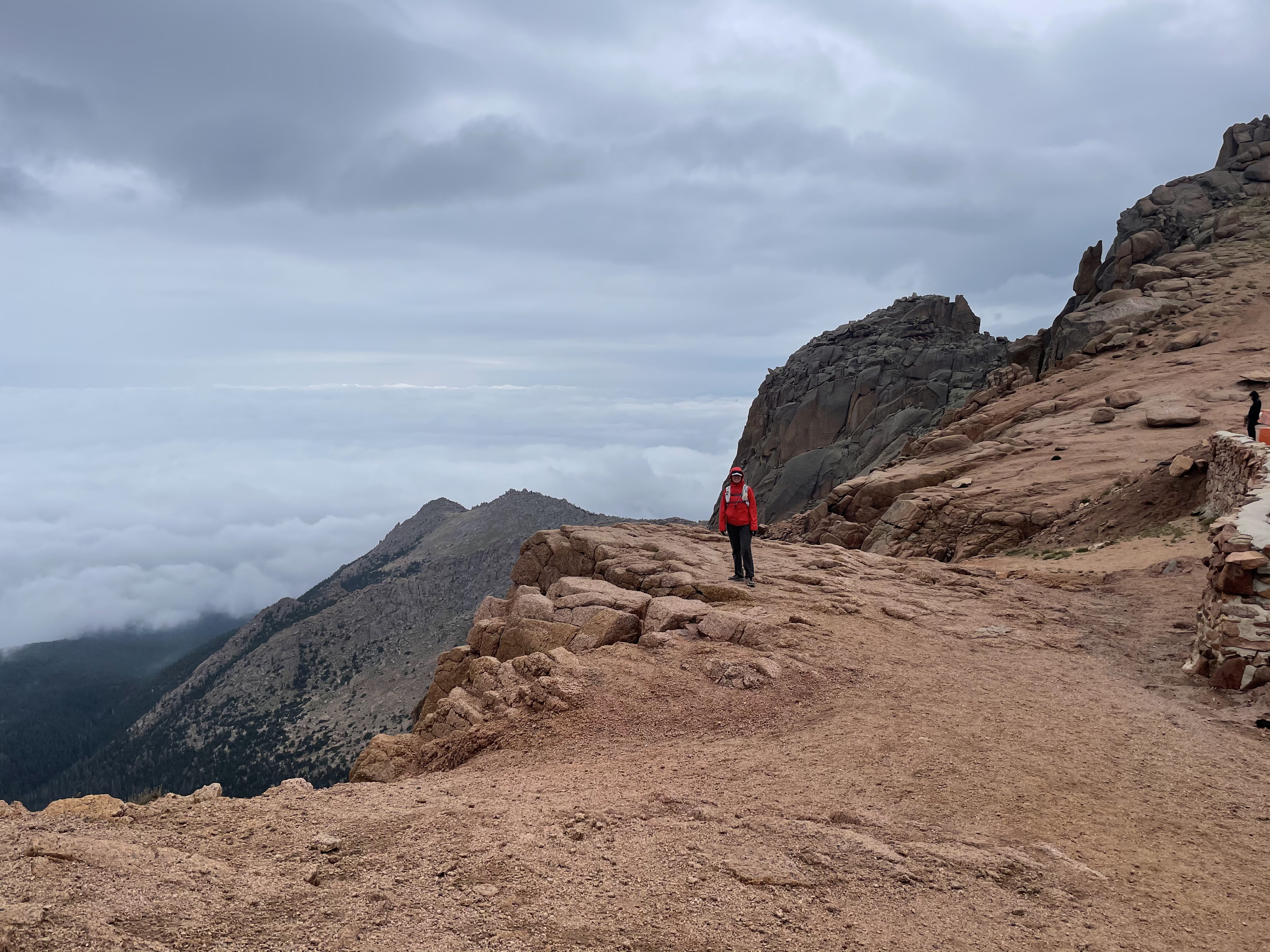
Justin descending from Challenger Point

Clouds started to build a little bit between us and Crestone Peak

Cool cactus were everywhere

View of the peaks we would later summit from Mt. Adams.  From left to right, Kitty Kat Carson, Columbia Point, Kit Carson and Challenger Point is the broad ridge from center to right


Geological survey marker on Mt. Adams

Justin and the view of the peaks on the hike into Willow Lake

View of the sunrise from near the summit of Mt Adams

Lots of big horn sheep were making their homes on the road out

Eureka Mountain

April 21, 2024 Eureka Mountain 13,505' Eureka Couloir Hoping to get some spring skiing in before the snow went away completely, I sugges...

Popular Posts