
Four Pass Loop Hagerman Peak
July 15-17, 2021
30.6 miles
It was 6 years ago that I first completed the Four Pass Loop with my friend Ethan. When Laura brought up the idea of going back I did not hesitate to jump at the opportunity. It was last year that she had asked if I’d like to go run it with her but I preferred backpacking to running the loop simply because the beauty goes by way too fast when you’re moving at a running pace. I remembered how perfect the scenery was that September of 2015 and I hoped that she would enjoy it the same as I did. Besides the beauty, the best part about going overnight was that we could take our 13 month old daughter Hazel with us. It would be her first overnight backpacking trip.
The Maroon Bells - Snowmass wilderness requires a walk up permit for overnight use. But new since 2020 is that you now need a permit to park overnight at Maroon Lake. We knew that permits would go fast so the morning they went on sale, Laura and I did our standard permit routine. Me on the computer at work, her logged in from home, both with specific dates we wanted and on the phone together too. These permits were surprisingly easy to secure in comparison to some of the others we’ve gotten like Havasua Falls, Mount Saint Helens and Mt. Whitney Zone in California. So, with parking secured and trip dates set, the wheels were set in motion.
We had not backpacked with Hazel before but were not new to the game. I did many trips before meeting Laura and we had done several, including a week in Patagonia and roughly 150 miles on the Camino in Spain while she was pregnant with Hazel. I knew we’d need to go fairly light on our own gear considering just Hazel and her pack would weigh almost 30 pounds! I figured we could be around 30 for all our gear and food, making the packs fairly even weight.
We planned out our meals and did a trial pack run a few weeks prior to leaving. It seemed like everything would fit in the 50 liter pack so that’s what we went with. I put diapers and some miscellaneous small items in Hazel’s pack along with our down jackets and bottles for her milk. We only use two pads and two sleeping bags as Hazel sleeps with us so we really didn’t have a whole lot of extra stuff than we would normally have.
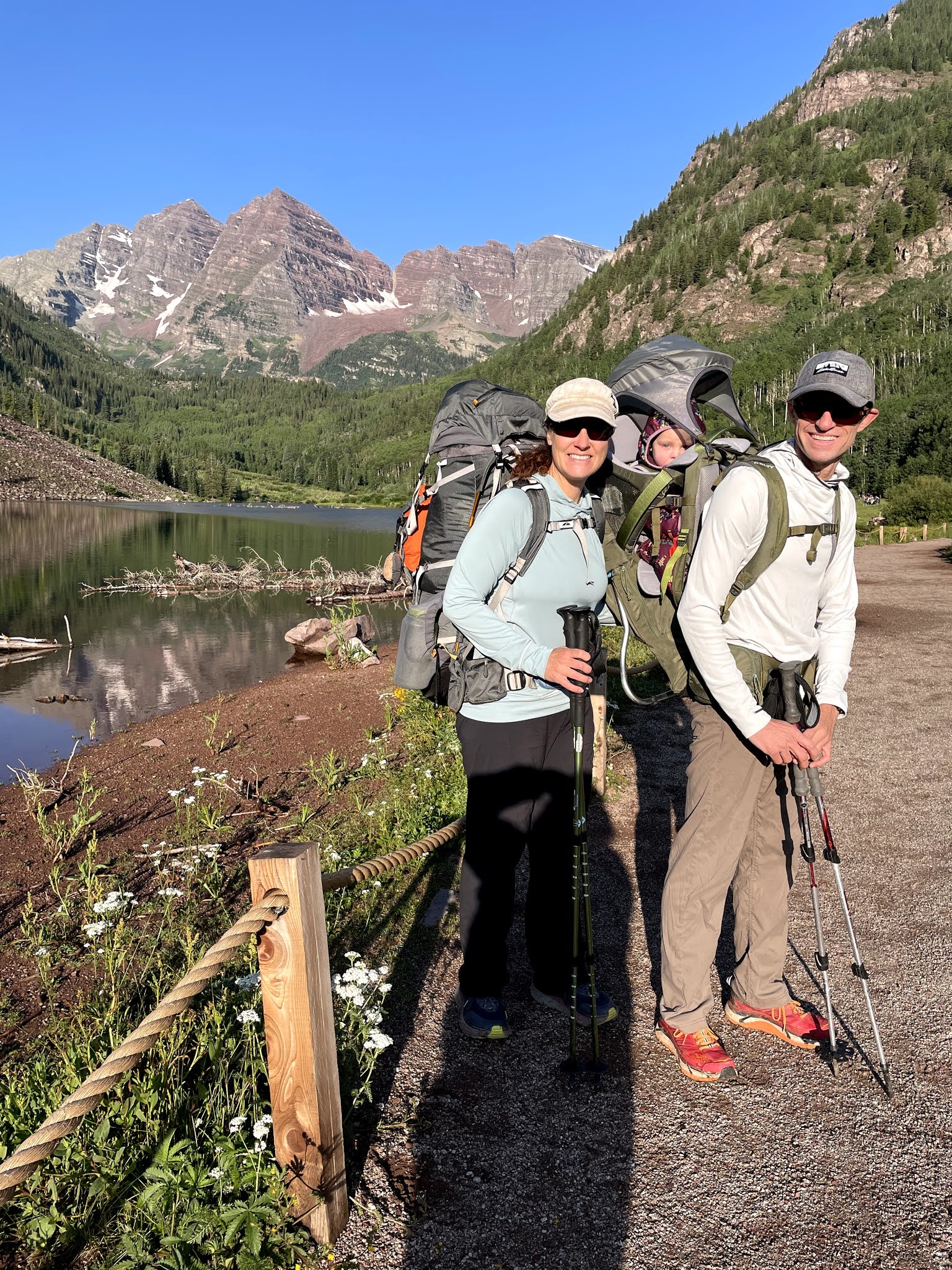
Our overnight reservation started on Thursday but since we wanted to start hiking early Thursday morning we decided to chance it and sleep in the back of the Jeep at the Maroon Lake overnight parking lot. We headed out after work and arrived around 8 pm. National Forest rangers were out cooking dinner but we pulled in like we knew what we were doing and they never questioned us. We ended up backing into a comfortable space and catching a few hours of sleep before our 6 am alarm the following morning. I warmed breakfast burritos while Laura got Hazel ready to go. After a final restroom stop at the trailhead we snapped a picture of us with the bells and were off at 7:30 am.
 |
| Headed out for the Four Pass Loop |
The 2 miles in and out from Maroon Lake to Crater Lake are rocky and are definitely the worst section of established trail. We chatted as we hiked this section saying that with the multiple times we’ve both climbed the Maroon Bells, Pyramid Peak and other mountains in the area, Laura and I had probably hiked this section of trail 15 or more times. The miles passed quickly and we were soon at the junction to Crater Lake. Turn left here and head toward Crater Lake if you’re doing the loop clockwise. Right takes you up Buckskin Pass.
 |
Hazel sleeping as we followed the trail past Crater Lake
|
 |
One of the first stream crossings
|
As we passed by Crater Lake we took in the views of the majestic maroon bells and continued on down the trail toward west maroon pass. There are several stream crossings here but nothing that warrants taking shows off. Just before starting up west maroon pass we stopped for a break and filled our Nalgene bottles. We each carried only one liter of water since water sources on the loop are fairly abundant. We also choose to use a steripen over a filter to save weight. We treated some water and had a snack while Hazel played in the dirt rocks.
 |
Taking a break, Hazel was super excited
|
 |
Hazel enjoying the backpacking on the way toward West Maroon Pass
|
After about 15 minutes, we began the climb toward the group of people we could see at west maroon pass. With steady work we were there at 11:30 am - 4 hours from our start time at Maroon Lake. We stopped and chatted with folks and had our lunch of peanut butter and tortillas. Hazel had a bottle of milk and an organic smoothie and of course, played in the dirt and rocks some more. People are impressed when they see us out with Hazel at such a young age but she is comfy and enjoys riding in the backpack. We have taken her on quite a few day trips, starting small and working up to longer distances to get her comfortable in the backpack and used to riding. She enjoys looking around and playing with rocks while I tell her endless stories and go through the alphabet with her saying goofy things and making her laugh. She usually falls asleep within an hour of being in the pack. We enjoyed the views back on the megamydal traverse and out toward Crested Butte from the pass and soon were headed down. This is the busiest section of the loop due to the Crested Butte to Aspen and vice versa hikers. We saw probably 100 or more people in just this mile long section; a lot more than the five I saw here in 2015.
 |
Final push to West Maroon Pass
|
 |
Enjoying some milk at West Maroon Pass
|
At the bottom of the descent from West Maroon, we turned right at the trial junction leading to Frigid Air Pass. Left at this trail junction takes you across the basin to Crested Butte. Frigid Air Pass is easy since you only have to gain about 500 feet after your descent from West Maroon. This is the longest stretch of the loop without water as well. While you can probably find a trickling stream somewhere, but don’t count on tons of fresh water from here until you're back in the forest of Fravert Basin. We worked our way to the summit of Frigid Air Pass at 1:30 pm and with a short break continued on since Hazel was fast asleep in the pack and we knew we still had a fair bit of distance to cover today. Our goal was to camp somewhere near the Crystal River crossing on night one, making our first day roughly 13 miles. Fravert Basin traverses behind the Maroon Bells and allows for a unique perspective of the traverse from Maroon to N. Maroon Peaks. Laura and I have both done the traverse multiple times and it is enjoyable in it’s own unique way. We last did it in 2018 via the Bell Cord couloir. If you’re up for a short read some time, check it out here.
https://wedostuffnow.blogspot.com/2018/06/maroon-bells.html
 |
Headed up Frigid Air Pass
|
 |
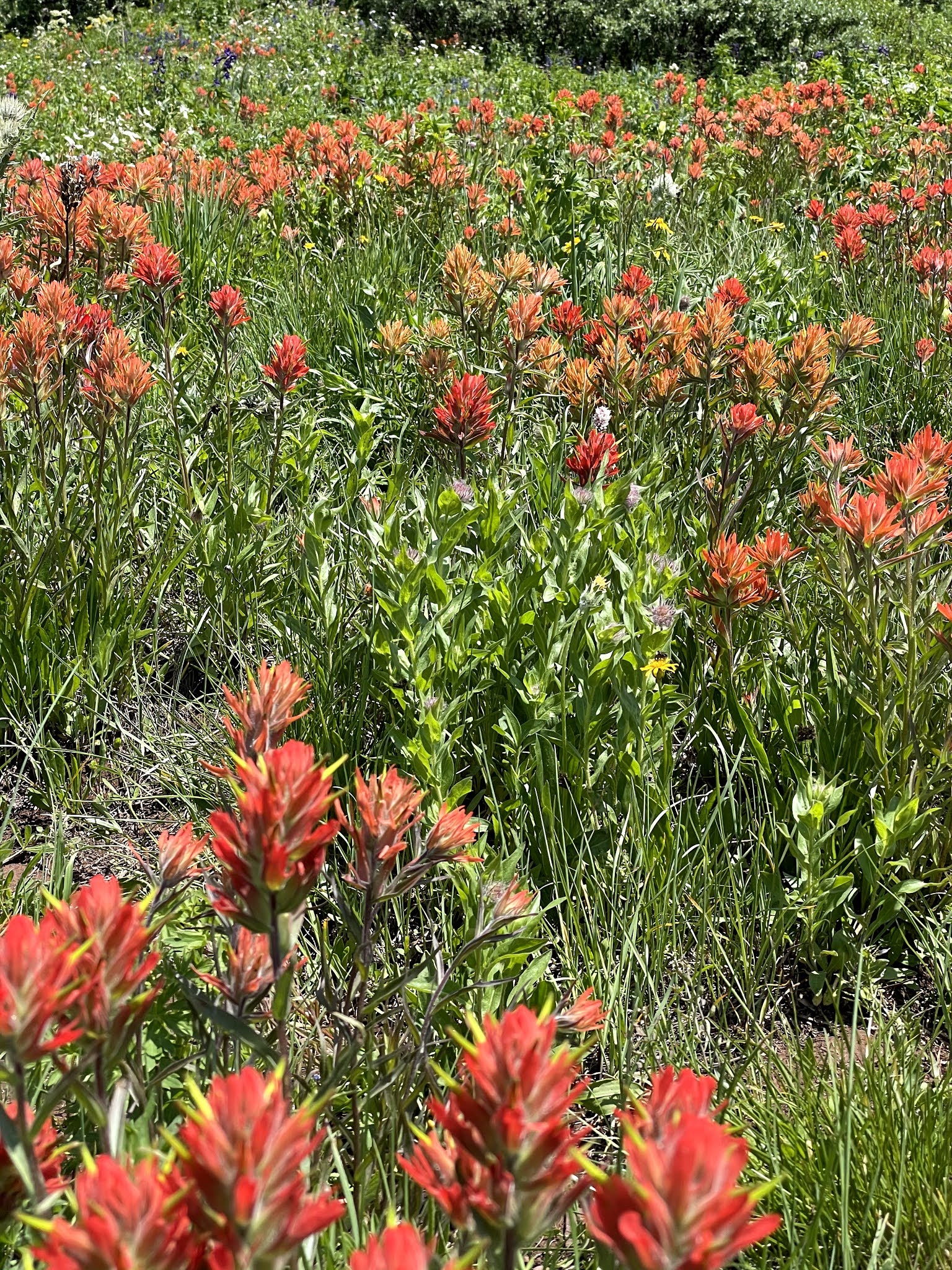
Amazing wildflowers in Fravert Basin with the Maroon Bells traverse in the background
|
From my previous trip on the loop I knew there was good camping all throughout the forested area of Fravert Basin, but wanted to get closer to the river today because of our plan for day 2. We found a good site close to the river crossing and had camp set up around 3:30 pm. As Hazel played in the tent, we saw a helicopter circling. We later learned that they had picked up someone who was hypothermic from being in the rain for several days prior. We wish them well and are proud of our awesome SAR teams here in Colorado!
 |
| Camp near the Crystal River in Fravert Basin |
I always bring a good dinner for the first night on the trail. Today it was cajun sausage with ramen and a fresh yellow pepper. I used to do dinner in a pot or larger cookware set but I learned a lot about cooking with a Jetboil when that is all we had for three weeks in Switzerland - so much in fact that a friend we made there gave me the trail name “Boils”. Anyways, we ate the excellent dinner, sipped some cheap whiskey and discussed our prospective route up Hagerman Peak for the following day. We were fast asleep by 9pm with 13+ miles in the books.
 |
| Justin enjoying his whiskey |
 |
| Hazel enjoying the tent |
 |
| Hazel making us laugh |
We started day 2 with a 6 am alarm. The morning was chilly with temperatures in the low 40’s overnight. Oatmeal with almonds and blueberries was the morning fuel while Hazel slept in. We were moving by 7:30 am. I didn’t bother to tie my shoes since we would cross the river within the first ¼ mile. The river crossing between Fravert Basin and Trailrider Pass is the only place where I’ve taken off shoes either time I’ve been on the loop. Today the water was about calf height and the 20 foot wide section of river was easily crossed. We met a group of five guys here that asked about our plans for the day. When I mentioned that we’d add in Hagerman Peak, Colorado’s 88th tallest mountain, they seemed impressed and asked several questions about it.
 |
Hazel sleeping in
|
 |
Getting bundled up for a chilly morning hiking
|
 |
| Gearing up after crossing the river |
As we started up the pass, our plan was to get to one of the streams and each down a liter of water. We would then refill and purify another liter which would last us until we were descending Trailrider Pass to Snowmass Lake. At the first of the four stream crossings on Trailrider pass, we followed our plan on water; drinking a liter and refilling.
 |
| Looking back at the Maroon Bells |
 |
| Lots of wildflowers everywhere |
While Laura hung out with Hazel, I pressed on. At 12,000 feet on Trailrider Pass is where I determined it was best to cut off the trail to access Hagerman Peak. It would be about a 2.25 mile round trip with an additional 1,800 feet of elevation gain.
 |
Having fun with Hazel with Hagerman in the background
|
 |
| Hazel took a nap while I ate a Snickers |
 |
| Hagerman on the left and Trail Rider Pass on the right |
 |
Hazel having fun while waiting for Dad to return
|
Laura had read that the south gully was extremely loose and dangerous and the southwest ridge to the summit was only slightly better, so I knew that route finding and careful rock hopping was in order. I set my pack on a pile of rocks and leaned it up as best as I could with poles, hoping that the marmots would stay away until she got there. A gulp of water and a handful of M&M’s went down as I tied my rain jacket around my waist. I knew I’d be moving fast so I did not take anything besides the jacket. I started out by crossing a flat area and traversed for almost a mile at 12,400 feet until I came to the south gully. Crossing the gully, the boulders and talus were not real stable and since I prefer more difficult scrambling to hiking up loose scree fields, I chose to ascend slightly from about 12,700’ and caught the ridge around 13,000’. Climbing the ridge was a moderate scramble at class 3-4 and was enjoyable for the most part. On the ridge I was able to see all around and it looked like there could be some rain clouds building. I knew that if I did not move quickly that Laura would not have the opportunity to summit safely, so with some hustle I reached the summit 1:04 after leaving the pack. I signed the summit register and was off the summit within a few minutes. I decided to descend the south gulley and mostly was able to keep a good pace through the unstable scree and talus. When I reached 12,700’ I again crossed over to the flatter area and rock hopped and ran as much as I could, making it back to Laura, Hazel and my pack 1:53 after leaving. Laura already had her rain jacket around her waist as I arrived so I greeted Hazel with a smile and Laura took off on her go at the mountain. As she ran off, I told her that if she went faster than I just had, we were going to have some serious competition problems. Laura followed my line for the most part and was able to summit and be back at the pack under 2 hours as well. She always says I am faster than her, but everyone knows that’s not always accurate.
 |
| Mountain goats, including a few babies, on the way up Hagerman |
 |
| Typical scrambling on the way up Hagerman |
 |
Summit of Hagerman, summit register in the foreground and the Maroon Bells in the background, Snowmass Lake on the left
|
 |
| Summit Register for Hagerman Peak |
I stayed with the packs for about 20 minutes and played with Hazel before she became sleepy. I loaded her up in the pack and finished climbing Trail Rider pass and slowly worked my way down to Snowmass Lake. This is one of my favorite parts of the Four Pass Loop and was Laura’s favorite. The scenery dropping down to the lake is incredible with the steep cliffs rising abruptly out of the lake. The wildflowers are amazing along the descent and if you take the time to look behind you, you get unobstructed views of Hagerman Peak. Thirsty, since I had not drank for almost three hours, I found some water about half way down the pass to the lake.
 |
| Looking back at Hagerman across Snowmass Lake |
 |
| Amazing views of Snowmass Lake |
 |
| Beautiful scenery coming down from Trail Rider Pass |
Upon reaching the lake, Hazel and I relaxed near the shore, ate some snacks and played while watching for mom! It was about 2:45 pm when Laura met us at the lake. Hazel was all smiles to see mom and we played by the lake shore for another 15 minutes while telling each other about our time on the mountain. Laura had a good laugh when the gentleman we met at the river crossing early that morning passed by on their way up Trail Rider pass. One of them said “she just hangs out and watches the kid while he goes off and does crazy shit”. He was surprised when she commented back that not only did she hear him and that I had already summitted and was headed down, but that when I got back, we would switch and she’d go do the same “crazy shit”. Yes, she is an amazing woman and is stronger than most men in the mountains. They didn’t respond and continued on their way up the pass.
 |
| Waiting on the shore of Snowmass Lake |
 |
| Hazel was all smiles |
When leaving Snowmass Lake, there are quite a few social trails, so be sure you’re on the correct trail leading up Buckskin Pass. We got caught up chatting with a guy who had said he passed a trail junction with a sign pointing to Buckskin Pass and ended up walking down the Snowmass Trail for about ¼ mile before consulting a map. Yes, there is a connection to Buckskin Pass on this trail but it would add at least a few miles to your day if you chose to take it. We backtracked and found the proper trail leading away from Snowmass Lake. There is a three way junction shortly after you leave the lake. One to Snowmass, one to Geneva and the last to Buckskin Pass. We took the appropriate turn here and continued on along the trail. It follows the river for quite a while and then eventually crosses a large flowing section of water.
 |
| Leaving Snowmass Lake |
We knew we wanted to camp higher up on the pass and get our miles in today rather than on our last day on the trail but were unsure of the water situation up higher on the pass. We asked a group of people about water up higher and they indicated that there was not any and to fill up now. That seemed peculiar to us and we really didn’t trust their observations. Maybe they didn't need the water so they never noticed it? I did recall water from when I did the loop years ago and so we chose to continue on without filling water. The next people we saw, just a half mile later, indicated that there was water a mile up and we should not have any concerns. So, take the advice of your fellow hikers with a grain of salt. We continued on until reaching an excellent water source that probably flows all year round. There were multiple established campsites here and we chose one with the closest neighbor probably ¼ mile away.
 |
| Another stream crossing between Snowmass Lake and Buckskin Pass |
 |
| Enjoying the trail together |
Finally arriving at camp today felt amazing as both Laura and I were tired from the long day and elevation gain. We calculated roughly 10 miles and 4,000’ of elevation gain. I set up the tent and as Laura and Hazel set up the pads and sleeping area, I cooked dinner. Tonight it was simpler than the first night since we brought freeze dried meals and a block of smoked and aged cheddar cheese. Dinners along with our remaining whiskey went down smoothly. I again hung the Ursack bear bag and placed our packs in trees to keep them safe from the rodents before sliding into my sleeping bag for the evening.
 |
| Campsite heading up Buckskin Pass |
 |
Hazel having fun at the camp
|
Alarm blaring at 6 am once again, our breakfast and camp break down routine stayed the same. Oatmeal and coffee while Laura put away pads and sleeping bags. I pack the backpacks while she eats and plays with Hazel and we’re out of camp within an hour. The remaining hike up Buckskin Pass is short from where we camped. It took us only 30 minutes to reach the top of the pass and, in my opinion, the best mountain views of anywhere on the entire loop. On one side, you get 14,000’ peaks Pyramid and The Bells with their red colored shale like rock and on the other you get the whitish, chalky 14,000’ summits of Capitol and Snowmass.
 |
| Hazel happy to be up for another day on the trail |
 |
| Amazing mountain views on the way up Buckskin Pass |
We relaxed and chatted with another group while taking in the views and feeding Hazel a few snacks for the morning. The descent down Buckskin pass has tons of water, so whether you’re ascending or descending here, fill up at your leisure. It took us about 1:30 from leaving the top of Buckskin Pass before reaching the junction back to Maroon Lake. The final two miles of trail are the longest but we enjoyed the hike along the rocky trail, chatting it up with the day hikers and encouraging the young ones to get out there and enjoy it. Back at the lake, we asked someone to take our picture with The Bells in the background and celebrated a wonderful family trip and perfect outdoor experience over the past 3 days. I would encourage anyone to get out there and go for this loop. It is well traveled, safe and a straightforward backpack trip. A strong fitness base and good altitude acclimatization will help immensely as will packing light.
 |
| One more stream crossing |
 |
Descending Buckskin Pass with Pyramid Peak in the background
|
 |
| Hazel having fun on the trail |
We get a lot of questions about adventuring with Hazel so here are answers to a few of the most common ones. We sleep with her using only 2 sleeping pads and sleeping bags. The bags stay unzipped. She sleeps between Laura and I and we lay her on one bag and cover her with the other. The three of us make somewhat of a cocoon. To keep her warm in the mornings, we have a Patagonia down suit. It is lightweight and packs down small while being super warm and having a comfortable hood to boot. Hazel seems to enjoy riding in the backpack but we did build up to longer mileage over a period of time. We started with short hikes and progressively took her on longer days or multiple day hikes in a row. Don’t skimp on an excellent baby carrier. We chose the Kelty Journey Perfect Elite and are very satisfied with it. It fits both Laura and I comfortably and carries amazing. It is pretty heavy at 7 pounds though! Altitude on the loop is a concern for a lot of people. We live at 6,000’ and spend time in the mountains with Hazel regularly, often times staying at the family cabin at 11,200’. Being acclimatized to the altitude helps us to sleep better at night and not have to worry about altitude sickness or headaches during the days.


No comments:
Post a Comment