13,822' "Lackawanna"

January 31, 2021
13,822' "Lackawanna"

Hiking on wind blown ridge
Laura and I left Colorado Springs to climb a winter route on a peak we thought would be avalanche safe and avoid the well established slide paths of "Lackawanna". We opted to ascend the southeast ridge and then traverse along the upper ridge to reach the peak safely. We drove past the open gate on Independence Pass and parked along the road just a mile past the usual closure. We were moving around 9 am and hoped we would be in for a mellow day but that would not be the case. The first 1/2 mile was very slow as Laura was not feeling well and needed to stop several times to eat, drink and adjust clothing layers. I did my best to break trail through the snow so she would not have to exert extra energy early in the day. As we approached the steeper slopes, avalanche and signs of instability were abundant. Whoomphing and shooting cracks were heard and seen several times so we discussed a line that we both knew would avoid any possible avalanche terrain traps. We headed across some low angle snow slopes and then ascended a steep scree filled slope to a wind blown ridge. 
Final push to the summit
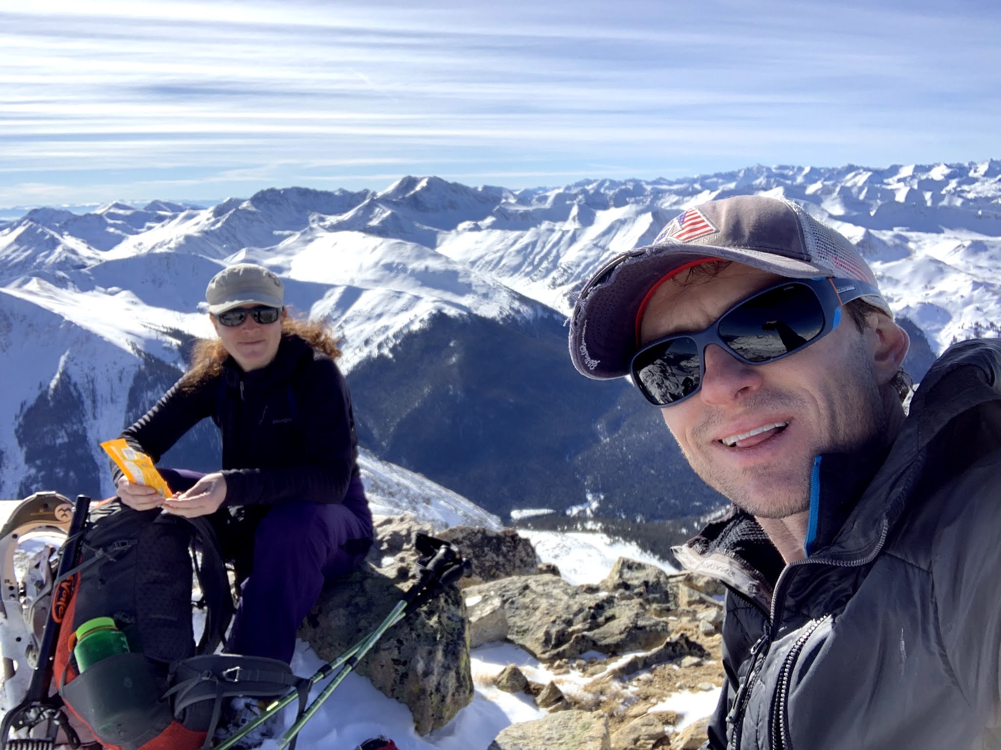
Following the ridge, we ended up almost directly east of the summit so we traversed across, ascended a class 3 section, sticking to rock bands as much as possible and finally reached the false summit of "Lackawanna". From the false summit it was a short walk across a rock field to reach the true summit at 13,822'. It had taken us almost 5 hours and both of us were tired. We were lucky to have a perfect winter weather day with sunshine and no wind so we enjoyed the summit for a few minutes before heading down. We descended to the west side of the snow filled avalanche gullies until we reached treeline. When we got to treeline, we chose gentle slopes and slogged through the snow, even setting a small avalanche - 1 or 2 feet wide - on a slope that was not steep enough to slide. We cautiously made our way to the car 1 1/2 hours after leaving the summit and were pleased to have had a fun experience on a mountain most do not seem to enjoy. 
On the summit!

Descent route

Back at the car!


Mt. Buckskin, Loveland Mtn. and Mt. Silverheels


January 16-17, 2021
Mt. Buckskin 13,865' 
Loveland Mtn. 13,692' 
Mt. Silverheels 13,822'

A weekend at the cabin with not so great weather meant we had better plan some mountains nearby. We had turned around on Buckskin the previous year when Laura was pregnant so we figured that we would go back and try once again. We would also attempt Mt Silverheels the following day. Friday evening we arrived to the cabin and were greeted with a large tree that had fallen on the rear entry steps. We would deal with that later. Laura's mom had gotten to the cabin earlier in the day and dinner was ready so we ate and relaxed for the evening. 
Saturday morning we woke to wind and cloudy skies. While not great weather for climbing a mountain, it was not unexpected and so we added layers and headed over to the trailhead. The short hike up the road and then onto the summit via the northeast slopes was uneventful. We were easily able to avoid any avalanche terrain on the mostly wind scoured peak and we summited after just 3 hours of battling with the high winds. 

While on the summit ridge, the skies began to clear just slightly so we figured we would hike over to Loveland Mountain and descend its gentle slopes directly to the Jeep parked at the trailhead. One hour across the ridge and we were on our second summit for the day. 
We enjoyed the beautiful winter views and ate a snack before heading down. When we reached treeline, we put snowshoes on and trenched a 2' deep track for 30 minutes back to the car. Round trip was exactly 5 hours car to car. We headed back to the cabin and cut the large tree that was laying across the stairs to the cabin before relaxing for the evening. 


Sunday we headed over to Mt. Silverheels with Laura's brother Brian. Accessed from the summit of Hoosier Pass, you have to cross several ridges to get to the mountains north facing slopes but it is easier than trenching through the deep snow low in the trees. 


Once again the wind was raging - probably in the 35 mph range for much of the day. We battled through and worked our way across slopes avoiding avalanche terrain along the way. We chose a couloir that was settled and snowshoed up the very edge to reach the summit plateau. It took us 4 hours to summit and we stayed for only a minute. 


The wind was blowing us all over as we raced off the mountain. Headed down, Brian fell and hurt his elbow and I would have the worst news imaginable. My mother called to let me know that my dog, Cammie, who was staying with her for the weekend was not doing well and that I should come home asap. We raced to get off the mountain but it was too late. Cam had passed as we descended. My best friend for 12.5 years went quickly and likely from an organ failure or burst cancer tumor. I am sorry that I was not there with her but I know she was comforted by my mom and dad and I hope it was easier for her to let go without me there. I know she would have tried to hang on longer had she seen me crying beside her. Cammie was an amazing family member and I can't wait to see her again. I know that she'll greet me with a bark!


Eureka Mountain

April 21, 2024 Eureka Mountain 13,505' Eureka Couloir Hoping to get some spring skiing in before the snow went away completely, I sugges...

Popular Posts