August 22, 2020
While large wildfires engulf the northern and western portion of Colorado, Laura and I thought we might escape the smoke path by heading west but as luck would have it, smoke from the California wildfires was swirling around and through Colorado too. So a smoke filled weekend began with our 6 hour drive to Ouray, a beautiful mountain town in southwest Colorado. Making a stop at Ridgeway State Park to break up the drive, we checked off Hazel’s 18th state park in just 12 weeks of life and did a few short hikes while we were there. We continued onto Ouray and grabbed a small cabin for Laura, her mom (babysitter) and Hazel. I decided to sleep outside since the cabin was small so I blew up my air bed and crashed in the dirt around 9 pm anticipating a 1 am wakeup. Either a dog or a fox came by to visit that night but I was too tired to catch what it was before it scampered off when it startled me from my sleep.
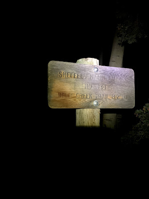
Eating bagels and boiled eggs as we drove toward Telluride and the Mill Creek Trailhead, we arrived and set off quickly at 2:15 am. Laura set the pace on the great trail as we chatted to keep wildlife aware of us in the dark. We came across a herd of elk and a few deer, but nothing to be concerned about. After about 4 miles of steep trail, we cut off onto the grass covered talus slope and began the slip and slide that defines much of the remaining route to the summit of Colorado’s 100th highest mountain and the one the guidebook says is the most difficult. As we climbed, slipped, clawed and crawled our way up the south slopes of Dallas Peak, we eventually reached the gullies and what we hoped would be more solid ground.
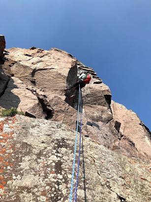
We were atop Dallas just before 7:30 am. The sunrise over Mt. Sneffles was spectacular due to the smoke but when we looked across the valleys to other mountains we have climbed, the smoke made for disappointing views. Laura made some milk for the kid while we had a snack on the summit. I set up the rappel on the recently installed cable with safe rappel rings and we began our descent at 8:05 am. I brought a 40 meter rope which turned out to be perfect length. Anything shorter would be too short. We did two rappels and got back on the path we had come up.
We were nervous about the descent thinking it would be dangerous with all the loose scree sitting on top of larger loose talus but we were fairly comfortable skiing down and hopping or down climbing facing in when the slopes called for clawing with your hands to keep from sliding down. As we passed back by the east face, we admired the potential climbing routes but figured the rock would be too poor quality to climb safely. As we continued down what we had ascended in the darkness of the night, I wondered why the heck anyone would go up this way when in fact it was the exact way we had come up! Seems ridiculous but I was happy to not know what we were going up in the darkness and how long you had to deal with the nastiness! We eventually made our way back to the good Mill Creek Trail and made quick work of the 4 remaining miles to the Jeep at 11:30 am. Roughly 11.5 miles and 5,600 feet of total elevation gain is what I recorded.


No comments:
Post a Comment